
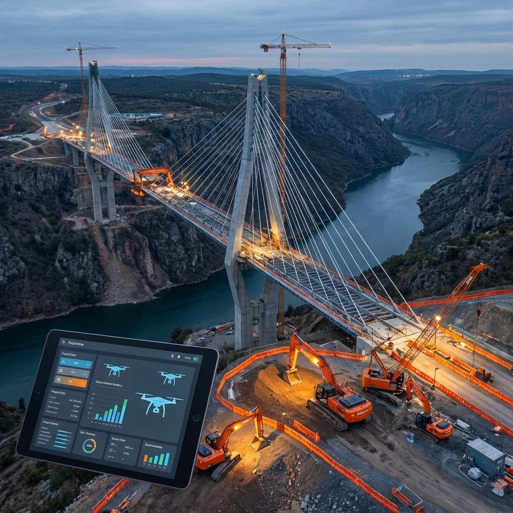
The construction and infrastructure industry is experiencing a technological revolution that’s fundamentally changing how we approach site surveys, progress monitoring, and project management. Traditional surveying methods that have dominated the field for decades are rapidly being replaced by drone technology that delivers superior results in a fraction of the time.
This transformation isn’t just about keeping up with the latest tech trends: it’s about survival in an increasingly competitive market where efficiency, accuracy, and safety can make or break a project’s success. Construction companies that continue relying solely on traditional surveying methods are finding themselves at a significant disadvantage.
The Speed Revolution: From Weeks to Hours
The most dramatic advantage of drone site surveys is the incredible time savings they provide. Traditional surveys that previously required extensive manual labor and equipment deployment over days or weeks can now be accomplished in just hours.
Here’s what this looks like in practice: A conventional topographic survey of a 100-acre construction site might require a team of 3-4 surveyors working for 2-3 weeks with expensive equipment. The same survey using drone technology can be completed by a single certified pilot in 2-3 hours, capturing thousands of high-resolution overlapping images that are processed into detailed topographic data.

Real-world results speak volumes. Major construction projects across India reported a 60% reduction in surveying time when switching to drone-based site surveys. This isn’t just about getting the job done faster: it’s about freeing up resources, reducing labor costs, and accelerating project timelines in ways that directly impact the bottom line.
The efficiency gains extend beyond the initial survey. Traditional methods often require multiple site visits as projects progress, with each visit requiring the same time-intensive setup and data collection process. Drones can provide regular progress updates with minimal setup time, enabling continuous monitoring without disrupting ongoing construction activities.
Precision That Transforms Project Planning
Accuracy has always been critical in construction and infrastructure projects, where small errors can lead to massive cost overruns and delays. Drone surveys generate highly accurate 3D maps and terrain models with precision within just a few centimeters: often exceeding the accuracy of traditional surveying methods.
Advanced drone systems integrate LiDAR technology that can penetrate vegetation and provide precise elevation data even in challenging terrain. This capability enables optimization of grading plans, drainage designs, and foundation layouts with a level of detail that was previously difficult or impossible to achieve cost-effectively.
The comprehensive data collection capabilities of drones mean that project teams have access to complete site information rather than the limited data points typically gathered through traditional surveying. This comprehensive view reduces the likelihood of encountering unexpected site conditions that can derail construction schedules and budgets.
Cost Savings That Impact Every Project
While the technology advantages are impressive, the financial benefits are what drive adoption in the construction industry. The cost savings from drone surveys extend far beyond simple labor reduction.
Traditional surveying requires significant equipment investments, from total stations and GPS units to vehicle fleets for transporting crews and equipment. Drone surveys eliminate much of this equipment overhead while providing more comprehensive data collection.

Labor cost reductions are substantial. A traditional surveying crew might cost $2,000-$4,000 per day depending on project complexity and location. A drone survey can typically be completed for a fraction of that cost while providing more detailed information. Over the course of a large infrastructure project with multiple survey requirements, these savings can easily reach tens of thousands of dollars.
Insurance costs also benefit from drone adoption. By identifying potential hazards early and improving overall site safety, drone surveys can help reduce insurance premiums. The detailed documentation they provide also supports better risk management and compliance reporting.
Perhaps most importantly, the reduction in human error: a major source of costs in manual measurements and observations: provides additional savings that compound over the life of a project.
Safety Advantages in High-Risk Environments
Construction and infrastructure projects often involve dangerous environments where traditional surveying puts personnel at risk. Tall structures, unstable terrain, active roadways, and hazardous materials create significant safety challenges for ground-based survey teams.
Drone technology eliminates much of this human exposure to risk. For difficult-to-access areas like tall structures, complex rooflines, or bridge inspections, drones eliminate the need for expensive scaffolding, aerial lifts, or helicopter flights. This is particularly valuable for civil engineering projects spanning vast areas where traditional methods are impractical, such as roads, bridges, dams, and utility infrastructure in remote or difficult terrain.
The safety benefits extend beyond immediate risk reduction. Comprehensive site documentation helps identify potential hazards before they impact workers, enabling proactive safety planning rather than reactive responses to dangerous conditions.
Comprehensive Documentation and Real-Time Monitoring
Traditional surveys provide a snapshot of site conditions at a specific point in time. Drone surveys transform this approach by enabling continuous monitoring and documentation throughout a project’s lifecycle.
This real-time progress tracking capability enables project managers to monitor multiple areas simultaneously, identify coordination issues between trades before they impact schedules, and maintain comprehensive compliance documentation. The objective, verifiable evidence provided by drone surveys replaces subjective ground-level assessments that can lead to disputes and delays.
For infrastructure projects that span years, the ability to maintain consistent documentation and track changes over time provides invaluable project management capabilities. Construction managers can quickly identify areas where work is falling behind schedule, spot quality issues before they become major problems, and provide stakeholders with visual progress reports that are far more compelling than traditional written updates.
Real-World Applications Transforming the Industry
The applications for drone technology in construction and infrastructure extend far beyond basic site surveys. Progressive companies are leveraging drone capabilities for:
Progress Documentation: Regular aerial photography and videography that provides visual proof of work completion and helps identify potential delays or quality issues.
Safety Inspections: Detailed inspections of structures, equipment, and work areas that would be dangerous or impractical for human inspectors to access.
Volumetric Analysis: Precise measurements of stockpiles, excavations, and material quantities that support accurate billing and inventory management.
Quality Control: High-resolution imagery that can identify construction defects, installation errors, or material issues from perspectives that ground-based inspections might miss.
Asset Management: Comprehensive documentation of completed infrastructure that supports long-term maintenance planning and regulatory compliance.
Companies looking to implement these capabilities can explore professional aerial video services that provide the expertise and equipment needed to maximize the benefits of drone technology in construction applications.
The Future of Construction Site Management
The transformation happening in construction and infrastructure surveying represents just the beginning of a broader technological shift. As drone technology continues advancing and regulations evolve to support expanded commercial applications, the capabilities available to construction professionals will only grow.
Artificial intelligence integration is already beginning to automate data analysis, identifying potential issues and optimizing construction sequences based on comprehensive site data. Real-time data streaming enables immediate decision-making rather than waiting for processed survey results.
The companies that embrace these technologies now are positioning themselves for sustained competitive advantage. Those that continue relying on traditional methods risk being left behind as the industry standard shifts toward drone-based solutions.

For construction and infrastructure professionals ready to make this transition, the key is partnering with experienced providers who understand both the technical capabilities and the practical requirements of construction projects. The investment in drone technology and training pays dividends through improved efficiency, reduced costs, enhanced safety, and better project outcomes.
The question isn’t whether drone technology will replace traditional surveying methods in construction and infrastructure: it’s how quickly your organization will adapt to remain competitive in this rapidly evolving landscape.
Leave a comment